Uppdates - Skåne's coast (2018-09-30)
Print 1, no written updates in English after 2019
Walk 3 (2018-09-30):
C. The red latrine is replaced by a new brown one, located on the other side of the river, but closer to the sea. The narrow path leading south is still clearly visible on the left side after 300m.
Walk 8 (2017-08-09):
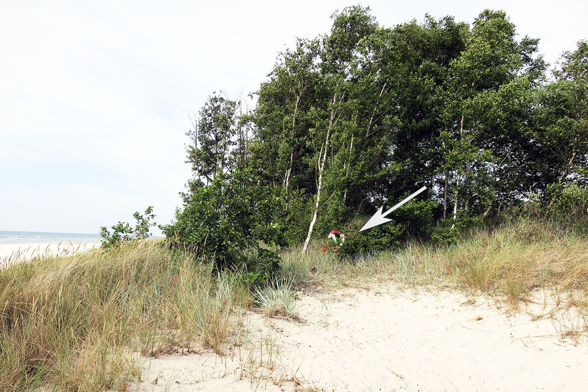
B. The bamboo pole is replaced by a lifebuoy

Walk 9;
A. The sea has eaten into the sand dunes, washed away some threes and the beach front dunes may be too steep to climb by the bamboo stick A (the flag is gone). Do the climb nearby instead (Thanks Göran)
Walk 15;
Go from A straight ahead along Brohusvägen; but take immediately left on a footpath before kindergarten Brohus. Continue along Höje river(without using any of the bridges) all the way to its outlet at C. Join C to B to D (now called Strandstråket) etc.. according to the book. At F starts a yellow trail that goes parallel with the bridle way; use this back to the starting point. With this update the trek will be 8km instead of 6.
Walk 16;
Page 75: You can´t go inside the burial chamber any longer; the entrance is closed.
Walk 18;
In facts: last line in the directions; Take a left at the Dag Hammarskjold road to Villa Thalassa. Accommodation - Villa Thalassa, hotel and room rentals Preamble: The walk starts along a coastal plateau behind Villla Thalassa (not a Youth hostel anymore) Below the trekking symbol; skip the following sentence: On the right hand side of the path you will pass some cabins belonging to the youth hostel (the cabins are demolished).
The sporadic yellow markings are now replaced by orange Skåneleden marks. Follow these to a turning place.
Walk 19;
Christian's fish shop and snack bar, opening hours from March to September k 11-16, tel 0708-153063 On the waterfront next to the starting point of the hike, there is now a shelter
A. The duckboards are removed.
B. The two-track forest road is initially a narrow path. Cinderella and Casanova is no longer in the paddocks.
D. Delete the first part of the sentence: On your left there will be a high fence,…..
Walk 23;
In the description on how to get to Stora Hult the book states use road 105 towards Torekov and then to Vejbystrand. There are two signs to Vejbystrand on road 105. If you are approaching from E6 the first sign is in the round about at Förslöv, don't use that one! take the second one. (Thanks Kjell Johansson!)
At Åsbacka Gård they are bothered by ramblers, avoid the farm by doing a shortcut directly from E to P.
Walk 28;
In the introduction, the hidden steps don´t exist anymore; just follow the path up!
from B it says: "…..shortly thereafter take a sporadically yellow-marked route on your left going down…. The path is closed due to "Suspended at risk of collapse '”
The coordinates are: 6264516 1309882 X Y (Steen Thanks)
E. Read instead: E. Take a right just before the harbor by turning back 180 degrees on a dirt road. The road goes steeply uphill ....... (the signs are gone)
